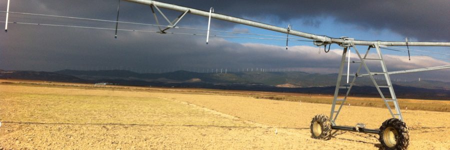
Many developing countries have become recently global agricultural suppliers. However, this has often achieved through an uncontrolled irrigation increase. Only a sustainable irrigation management will keep the agricultural production levels.
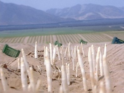
For instance, Ica Valley, Perú, is now one of the largest asparagus producers of the world.
The Ica Department contributes more than 3% of the Peruvian Gross Value Added (GVA). It is due to the boom in export agriculture.
The area planted with asparagus has grown from 400 to over 10 000 ha in just 20 years. Area of Vineyards and other crops has also grown.
Most of the irrigation water comes from groundwater. The abstraction from aquifers has increased to the same extent as the agricultural area.
The use of the Ica aquifer significantly exceeds the exploitable reserve (190 hm3/year). There is an over-exploitation of 76%, bringing water table decreases and increasing the aquifer salinity.
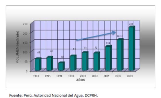
Agricultural production in the Ica Valley will be very limited in the medium term. Therefore, a sustainable irrigation management should be adopted.
On the other hand, Climate Change and its associated climate variability have brought additional pressure on water resources. Furthermore, Peru is one of the countries most exposed to the climate variability associated with El Niño – Southern Oscillation.
Over abstraction of water resources adds to the effects of climate change.
That is why the Government of Peru estimates that about 70% of the cultivated areas will be affected by the scarcity of water in 2021.
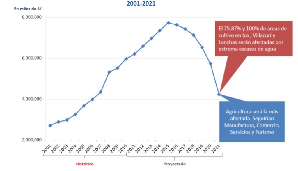
Agricultural production in the Ica Valley can still be saved. For this, sustainable irrigation management must be adopted. Aquifers should be recharged and extreme overexploitation should be avoided.
There are efficient simulation tools available, such as hydrological models and crop models. These models can be used to evaluate the risks that the agricultural production of Ica Valley faces. Sustainable solutions can be found from the simulations. We suggest following an approach based on the ISO 22301 standard with the following actions:
- Building an
Agricultural Database
It includes weather information from the Valle stations, soil maps, agronomic management (irrigation, sowing and harvest dates, fertilization, etc.). We recommended to use the available information, as well as to take additional soil samples.
- Building a
Hydrological Database
Comprises information on aquifers, wells and extraction. Geological and hydrological maps must be available. It is recommended to use the available information. However, we recommend as well as to perform pumping tests in the wells. These measurements will be used to estimate the hydrological parameters required in the model MODFLOW. Creation of the spatial database in QGIS, following the recommendations of FREEWAT and designing the Conceptual model.
- Conducting
Agricultural Simulations
Conducting simulations with a crop model. Simulations must estimate actual crop water demand, water infiltration losses and total water and energy costs. We especially recommend the physical-based agro-hydrological model SWAP. Deficit irrigation options, as well as changing crops should also be simulated.
- Conducting
Hydrological simulations
Considering the outputs of crop simulations as input for hydrologic simulations with FREEWAT-MODFLOW in QGIS. This includes saturated and unsaturated zones for the entire basin. The effect of current irrigation on the water table and salinity levels should be estimated, as well as the effect of other considered options such as deficit irrigation or crop change.
- Recommending
Sustainable irrigation management
All recommendations should optimize irrigation, increasing efficiency, adjusting doses and frequencies to crop needs and reducing deep infiltration and water and energy losses. The proposals should also guarantee the recharge of the aquifers and avoid salinization. The recommendation feasibility, from the users point of view, will be evaluated through meetings with the communities of irrigators, farmers, regional authorities and competent water administrations.
- Conducting
Climate Risk analysis
The effect of extreme droughts should be simulated, taking into account both current and proposed irrigation management, as well as scenarios for water availability and possible market fluctuations. For the simulations, drought scenarios will be generated from a weather generator, considering historical series of the site. Likewise, the risks associated with Climate Change will be analyzed, using the scenarios developed for this area of Peru. Risk analysis should establish the long-term sustainability of agriculture in the Valley.
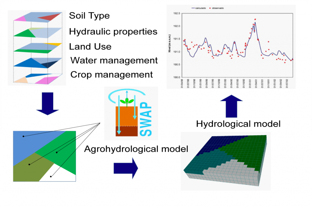
The procedure includes simulations in saturated and unsaturated zones, taking into account the actual agricultural management from the farms and the actual situation of the water tables.
Farmers and businesses based in the Ica Valley will have an Audit of the current irrigation management, made from simulations. They will receive recommendations too.
The simulations will estimate the current irrigation efficiency. They will point out the extent to which the water needs of the crop are met, what are the losses by infiltration and the total costs in water and energy. The audit will also establish over abstractions of water resources and the consequences it can bring. The proposals should ensure sustainable management of irrigation, which retains the profits of farmers while protecting the water resources of the Ica Valley.

