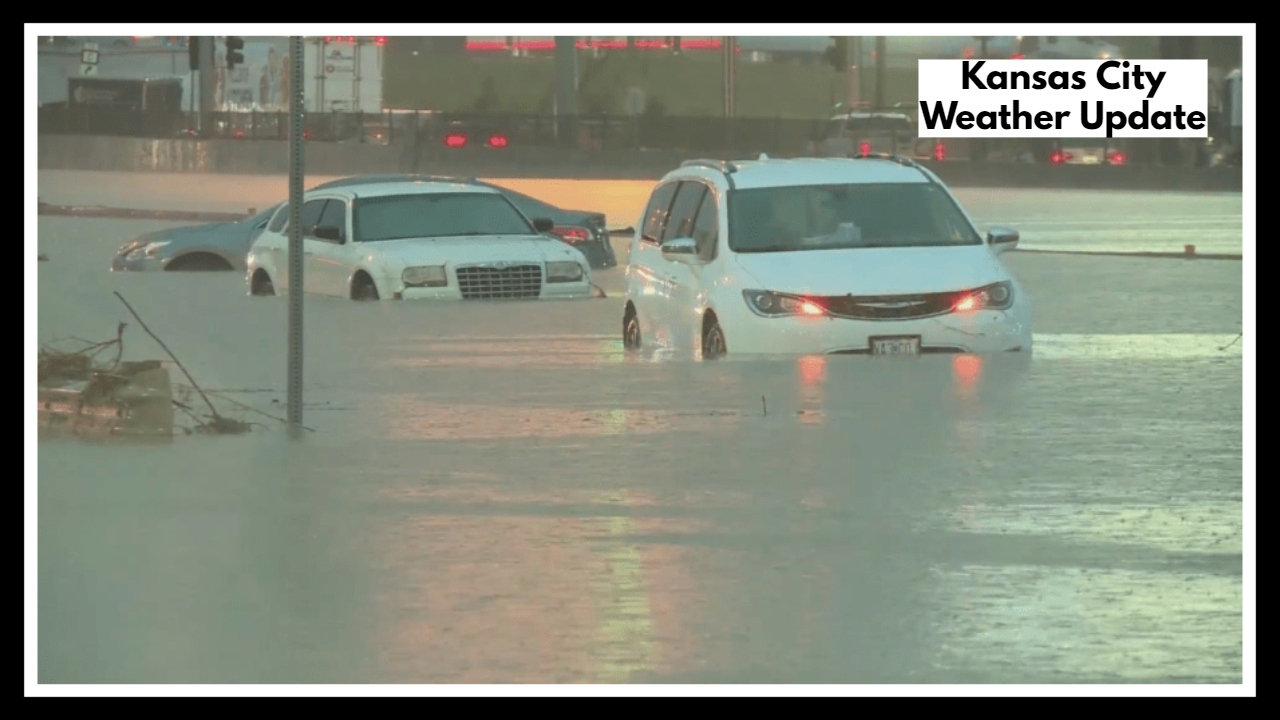
Kansas City Weather Update: Overnight Storms Could Bring Dangerous Flash Flooding
If you’re in the metro or surrounding areas, this Kansas City Weather Update is one to take seriously. A major storm system is moving in and it’s bringing more than a passing shower. Forecasts show up to 4 inches of rain, scattered strong thunderstorms, and even a chance for isolated tornadoes between now and late Tuesday night. For families, commuters, and anyone working outdoors, now is the time to be alert.
What’s Going On?
We’re in the middle of a moisture-rich weather pattern pulling in unstable air from the Gulf. The result? Heavy, slow-moving rain that could quickly overwhelm streets and storm drains, especially in lower-lying parts of the city. If you’ve dealt with flooded basements or impassable roads before, you know this isn’t just noise—Kansas City is vulnerable when heavy rain lingers.
This isn’t only about water, though. The Kansas City Weather Update includes more severe possibilities. As the atmosphere becomes increasingly unstable Tuesday afternoon into the evening, there’s a window for strong to severe storms. That means wind gusts strong enough to snap tree limbs, hail, and yes—an isolated tornado or two can’t be ruled out.
Why It Matters Right Now
Parts of the city are still drying out from recent rain, and the soil can’t hold much more. That raises the risk of flash flooding. For drivers heading home from work or families picking up kids from summer camps, that can quickly turn into a dangerous situation.
Even more concerning? Storms will ramp up after sundown—a time when visibility drops and people are less tuned in to alerts.
What You Can Do Right Now
-
Stay weather-aware through Tuesday evening. Have a reliable source for alerts—don’t count on just one app.
-
Avoid low-lying roads or known flood-prone areas if heavy rain begins to fall.
-
Charge phones and backup batteries in case power is knocked out during overnight storms.
-
Talk to your kids or elderly neighbors to make sure they know what to expect and how to stay safe.
-
Secure patio furniture, trash bins, or anything that could blow away if winds pick up.
Kansas City Weather Update: What Comes After the Storm?
The good news? Once this storm system moves out late Tuesday into early Wednesday, skies will begin to clear. That said, any flooding or damage left behind could take days to address. If you’re impacted, take photos, contact your insurance company, and watch for community recovery announcements.
FAQ About Kansas City Weather Update
1. Are we really getting that much rain?
Yes—forecasters say we could get up to 4 inches, and it’s not just a drizzle. The heaviest rain is likely to fall between Monday night and Tuesday evening, and that could mean fast-moving water on roads or even basement flooding in spots that usually have trouble draining.
2. Should I actually be worried about tornadoes this time?
It’s not a full-on tornado outbreak, but yes—there’s a chance. The atmosphere is unstable, and Tuesday afternoon into the evening is when we could see a few rotating storms. Nothing’s guaranteed, but it’s one of those times to stay alert, not anxious.
3. Which neighborhoods are most likely to flood?
If your street floods during heavy rain, plan for that again. Downtown spots, areas near Brush Creek, and some suburban low-lying zones could flood fast. If you’re not sure, it’s a good idea to move your car to higher ground just in case.
4. Will the storms hit while we’re sleeping?
That’s the concern. Some of the stronger storms could roll in after dark, and those are harder to see and prepare for. Keep your phone volume up for alerts, and maybe don’t put the weather radio away just yet.
5. What can I do now to stay safe before it gets bad?
Honestly, a few simple things can go a long way:
-
Charge your phone and any backup batteries.
-
Pull inside anything outside that could blow away.
-
Check in with your parents or neighbors, especially if they might need help.
-
And if you know your basement floods, move valuables up higher now—don’t wait until the rain’s pouring.