Ohio Weather Alert: Intense Heat Thursday, Dangerous Thunderstorms Friday Night
If you’re in Ohio this week—especially anywhere between Cincinnati and Columbus—you’re in for a weather rollercoaster. The latest Ohio Weather Alert is all about intense heat, hazy sunshine, and the threat of thunderstorms on the horizon. Thursday is shaping up to be one of the hottest days so far this season, and just as quickly as the sun blazes down, storm clouds could take over by Friday night.
Searing Heat Thursday Across the I-71 Corridor
The summer heat is officially turning up. Forecasts are calling for highs near 90°F in both Cincinnati and Columbus, with temperatures likely to feel even hotter thanks to rising humidity. Thursday will start out with patchy morning fog in some spots, but that will quickly give way to hazy sunshine and a dry, sweltering afternoon.
If you’re headed outdoors—whether to work, run errands, or enjoy a bit of early summer sun—be mindful of the heat. This kind of spike in temperature can take a toll, especially on young children, the elderly, or anyone with respiratory conditions. And with the potential for poorer air quality as the day heats up, it’s smart to limit outdoor activities during the afternoon peak.
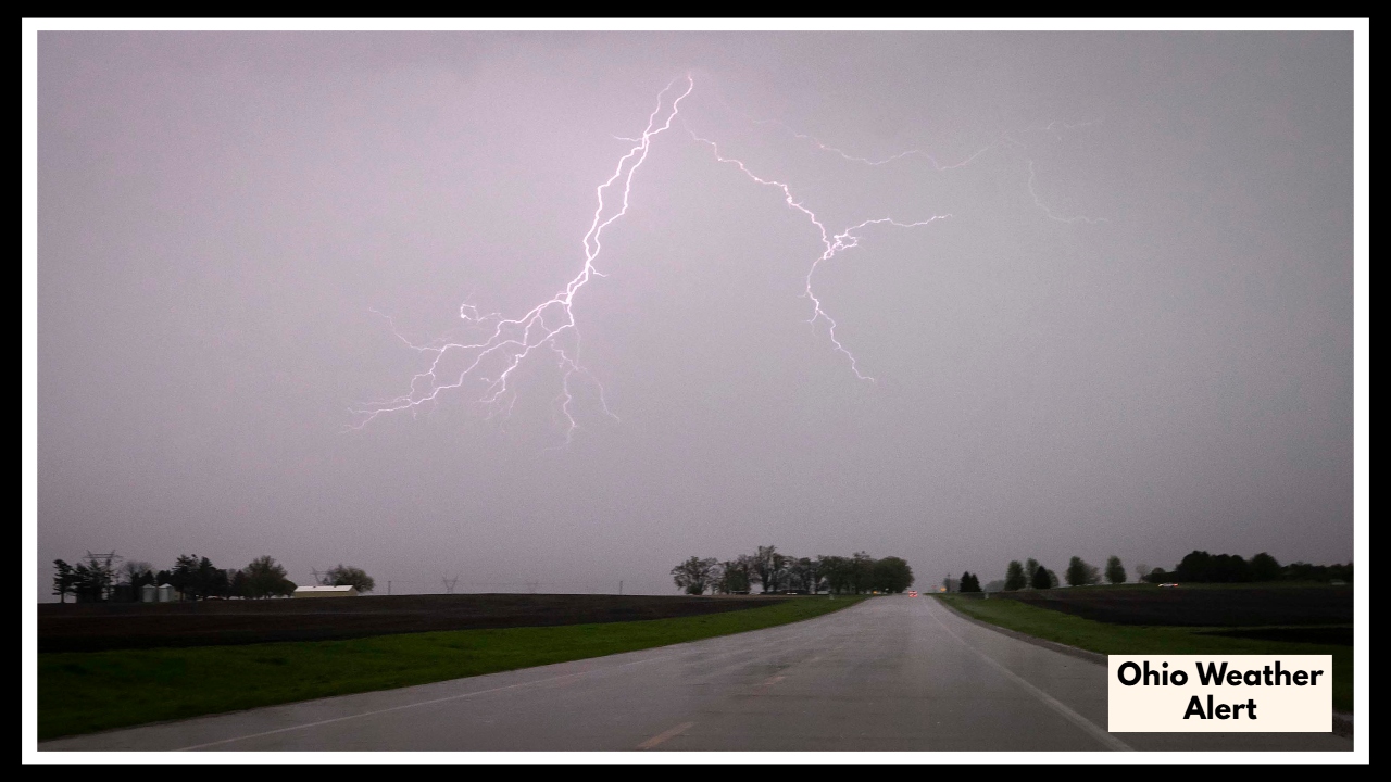
Ohio Weather Alert: Thunderstorms May Disrupt Friday Evening Plans
Just as we adjust to the summerlike heat, the atmosphere looks ready to shift gears. Another Ohio Weather Alert is in effect for Friday as a cold front pushes into the region, bringing with it a high chance of showers and thunderstorms—mainly from late afternoon into the night.
Current models suggest a 40–70% chance of storms for both cities. The timing may vary, but the evening commute and any late Friday plans could be impacted. Stronger cells could bring gusty winds, brief downpours, and lightning. It won’t be a washout for everyone, but it’s definitely worth keeping an umbrella handy—and staying weather-aware.
Looking Toward the Weekend
After the stormy end to the week, Saturday will bring some relief in the form of cooler air and lower humidity. Highs should dip into the upper 70s, though scattered showers could still linger. Sunday looks more promising with a return to fair skies—perfect for catching up on anything washed out by Friday’s storms.
What You Need to Know
-
Thursday: Highs near 90°F, hazy sunshine, and possible air quality concerns.
-
Friday: Thunderstorms likely by evening—have a backup plan if you’re headed out.
-
Saturday–Sunday: Cooler and more comfortable, but watch for leftover rain early in the weekend.
As always, keep an eye on live forecasts and weather alerts from local stations to stay ahead of any changes. The weather may be warming up—but it’s far from predictable.
FAQ About Ohio Weather Alert
1. How hot is it really going to get on Thursday in Ohio?
Temperatures are expected to climb near 90°F across central and southwest Ohio, including cities like Cincinnati and Columbus. With humidity added in, it could feel even hotter—especially during the afternoon. It’s the kind of heat that makes staying hydrated and limiting sun exposure especially important.
2. Will there be any health risks with the heat on Thursday?
Yes, there’s a chance of moderate air quality concerns, especially for people with asthma or respiratory issues. High heat and stagnant air can trap pollutants, so it’s smart to avoid strenuous outdoor activity during peak heat hours—usually between 12 PM and 5 PM.
3. When are the thunderstorms expected to hit on Friday?
Storms could roll in by late afternoon or early evening on Friday, with a 40–70% chance across most of the region. Some may be strong, bringing gusty winds, heavy rain, and lightning. The worst of the weather is expected to pass by late Friday night.
4. Will the weekend be clear after the storms?
Saturday will be cooler and less humid, but there’s still a slight chance of scattered showers during the day. Sunday looks like the better bet for clearer skies and comfortable temps, so you might want to save your outdoor plans for the second half of the weekend.
5. Do I need to change my plans for Friday evening?
It wouldn’t hurt to have a backup plan. If your plans are outdoors, you may want to reschedule or keep a close eye on the radar. While not everyone will see storms, there’s enough of a chance—especially along the I-71 corridor—that you could get caught in a sudden downpour or a brief but strong thunderstorm.