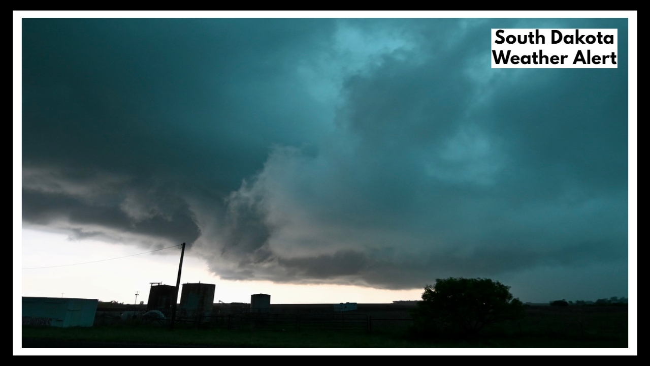
South Dakota Weather Alert: Dangerous Hail, 70 MPH Winds, and Tornadoes Could Hit This Evening
South Dakota Weather Alert: If you live in or around Sioux Falls, it’s time to pay close attention to the sky. A line of strong to severe thunderstorms is expected to sweep across southeastern South Dakota this evening, with the most dangerous weather likely between 4 p.m. and 10 p.m. Tuesday. Forecasters are warning of large hail, damaging winds, and even the chance of an isolated tornado—making this a serious evening weather threat.
This system isn’t your typical summer shower. It’s the kind that can go from calm to chaotic in minutes. So whether you’re picking up kids from practice, running errands, or just thinking about grilling dinner, it’s worth pausing to check the radar and prepare.
Why the Sudden Weather Threat?
An approaching cold front is clashing with hot, humid air over the region—creating a perfect setup for explosive storm development. And while that might sound dramatic, it’s exactly what weather models are showing.
In fact, the South Dakota Weather Alert includes the possibility of supercell thunderstorms—the kind that can produce hail up to two inches in diameter, winds up to 70 mph, and brief tornadoes, especially in open or rural areas. The National Weather Service has placed much of southeast South Dakota, including Sioux Falls, in a risk zone that calls for serious attention.
What to Expect If the Storms Hit
If these storms roll through your area, here’s what they might bring:
-
Golf-ball-sized hail that could damage cars, roofs, and siding
-
Strong, straight-line winds that can take down tree limbs or knock out power
-
Localized flash flooding, especially if heavy rain falls quickly
-
Frequent lightning, which poses a threat even without wind or hail
-
And in the worst-case scenario, an isolated tornado
The hardest-hit areas are expected to be along and south of I-90, including Sioux Falls, but storm tracks can shift. Being ready matters.
Stay Safe, Stay Ready
Here are a few simple things you can do now:
-
Keep phones and flashlights charged
-
Move your car into a garage or sheltered spot if possible
-
Secure anything loose outdoors—grills, umbrellas, garden tools
-
Know your safe spot in the house (basement or interior room)
-
Stay tuned to a trusted local weather source for updates
The Good News
By midnight, the worst of the weather should move out, and calmer, cooler air is expected to follow on Wednesday. But until then, stay weather-aware. A quiet afternoon can flip into a dangerous evening faster than you think.
FAQ About South Dakota Weather Alert
1. What’s this South Dakota Weather Alert really about?
If you’re in or around Sioux Falls, this alert is a heads-up that we could see some serious storms today—through 10 p.m. Tuesday. Forecasters are tracking the potential for large hail, strong winds, and even a tornado or two. It’s not a guarantee that every neighborhood will be hit hard, but the risk is high enough that it’s smart to stay alert and be ready to act quickly if things escalate.
2. When is the storm most likely to hit, and where?
The most active window looks to be between 4 p.m. and 10 p.m., with storms developing in the afternoon and moving eastward through the evening. While Sioux Falls is right in the potential path, places like Mitchell, Brookings, and areas along I-90 could also be affected. These types of storms can shift quickly, so the best approach is to stay weather-aware throughout the evening.
3. What kind of weather are we talking about—how bad could it get?
It could get rough in spots. Expect the possibility of:
-
Golf-ball-sized hail that can dent cars and crack windows
-
Wind gusts up to 70 miles per hour, strong enough to knock over trees and power lines
-
A chance of isolated tornadoes, especially with fast-moving supercells
-
Heavy rain and lightning that can make travel and outdoor activities dangerous
It might not hit everyone—but if you’re in the path of a storm, it could pack a punch.
4. Is there anything I should do to get ready?
Absolutely, a few simple steps can make a big difference:
-
Charge your phone and keep a flashlight nearby
-
Bring in anything from your yard or balcony that might blow away
-
Know where your safe place is in case a tornado warning is issued (a basement or interior room works best)
-
Keep an eye on trusted weather updates—TV, radio, or a weather app
-
Try to wrap up errands or outdoor plans before late afternoon if possible
5. Will the storms last all night?
The worst of it should be over by 10 or 11 p.m., though a few lighter showers could hang around a bit longer. The good news? Once the front moves through, we’re in for cooler, calmer weather on Wednesday—so it’s just one rough evening to get through.