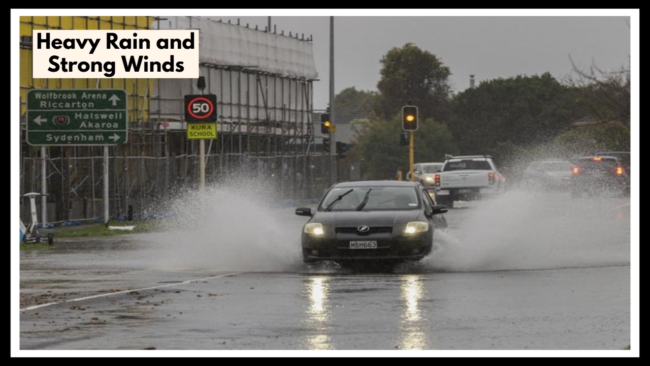
Warning: Heavy Rain and Strong Winds Set to Hit Detroit—What You Need to Know
If you’re in Detroit or the surrounding areas, you might want to brace yourself for a bit of a stormy Thursday. A Michigan Thunderstorm Alert is in effect, and things are about to get wet and windy. Heavy rain, gusty winds, and the possibility of thunderstorms will be making their way across the area, and it looks like the worst of it will hit in the afternoon and stick around through the evening. Whether you’re staying home or out and about, now’s the time to stay informed and be ready.
The rain will start later in the day, and as temperatures rise, the storm will start to gather strength. Thunderstorms could pop up by the afternoon, bringing with them some heavy downpours, strong winds, and the potential for flash flooding. If you’ve got plans to be out, it’s probably a good idea to make sure you’ve got a backup plan and check the forecast before heading out.
What You Should Know About the Michigan Thunderstorm Alert
Here’s what you can expect as the storm rolls in:
-
Heavy Rain: Don’t be surprised if you get caught in a downpour. The storm will bring quick bursts of rain, which could make the roads slippery and reduce visibility. Low-lying areas might also see some flooding, so be cautious if you have to drive or walk in those spots.
-
Wind Gusts: While we’re not expecting hurricane-force winds, gusts up to 22 mph will definitely make the storm feel stronger. These winds could create tricky driving conditions, so it’s best to slow down and keep your distance from other cars if you must be on the road.
-
Thunder and Lightning: Along with the rain, expect some thunder and lightning. This can make things dangerous, especially if you’re caught outdoors or near tall structures. If you hear thunder, head inside until the storm passes.
-
A Cool Down: After all that rain, temperatures will drop, bringing some relief from the heat. Highs will only reach around 73°F (23°C), which will feel refreshing compared to the recent hot spell. And by tonight, the temperature will dip to a cool 54°F (12°C), so keep a jacket handy if you’re heading out in the evening.
How to Stay Safe During the Michigan Thunderstorm Alert
Stay safe and prepared with these tips:
-
Avoid Driving During the Storm: If you don’t have to travel, it’s best to stay off the roads. If you must drive, be sure to slow down, keep a safe distance from other cars, and avoid roads that may be flooded or hard to see due to rain.
-
Stay Inside When the Storm Hits: The storm could get intense, so it’s best to stay indoors, especially when the heaviest rain and strongest winds hit. Avoid windows and doors, since they can be risky during strong winds or lightning.
-
Prepare for Cooler Weather After the Storm: The storm will bring some much-needed cooling down, so if you’re heading out later, throw on a jacket or sweater to stay comfortable.
-
Stay Updated: Weather can change fast. Make sure you’re checking your weather app or local news to get the latest updates. The storm might clear up quicker than expected, or it might linger longer, so it’s always a good idea to stay in the loop.
What Happens After the Storm?
Once the storm moves out, expect some relief. Friday will bring clearer skies and cooler temperatures, with highs in the mid-60s, making it a great day to get outside. But remember, Michigan weather is known to shift quickly, so always be prepared for changes, even when things seem to be clearing up.
For now, hang in there and stay safe through the storm. Once it’s over, you’ll get to enjoy the calm, cool weather that follows.
FAQ About Michigan Thunderstorm Alert
1. How long will the storms stick around in Detroit?
The worst of the weather should move through by late Thursday afternoon into the evening. After that, it’ll calm down, but roads could stay slick and a little breezy well into the night.
2. Are these storms going to be severe?
They’re not expected to be dangerous in a widespread way, but don’t take them lightly. We’re looking at heavy downpours, strong wind gusts, and thunder—enough to make driving tough and potentially cause minor flooding in low spots.
3. Should I change my plans for today?
If you’ve got flexible plans—especially anything outdoors or involving a lot of driving—it’s a good idea to reschedule or push them to later. The afternoon commute could be messy, so giving yourself extra time or staying in might be the better call.
4. Is it going to cool down once the storms move out?
Definitely. We’ll see highs in the low 70s during the day, but once the rain clears, temperatures will dip into the 50s by Thursday night. A hoodie or light jacket should come in handy if you’re out and about in the evening.
5. What’s the best way to stay in the loop with weather updates?
Check a reliable local news station, use a weather app like Weather Channel or AccuWeather, or follow the National Weather Service online. Weather can shift quickly, and a heads-up could make all the difference.